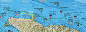
San Clemente Is Boater's Guide
Shipping calculated at checkout
In stock
Private Boater's Guide to San Clemente Island
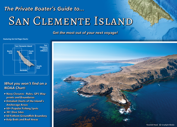
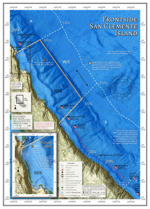
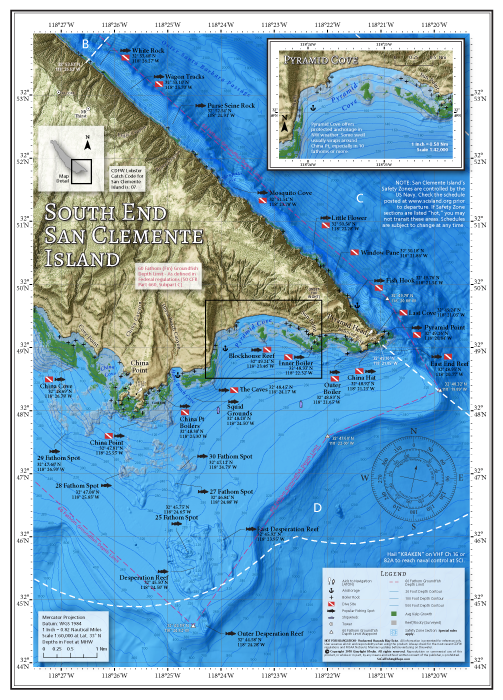
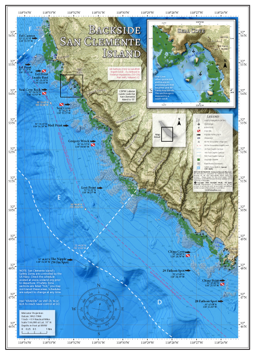
After the successful release of our Catalina Island title, we are proud to introduce The Private Boater's Guide to San Clemente Island. Containing all the information a private boater needs on a voyage to SCI, this spiral-bound and laminated guide offers a collection of maps that show this legendary Southern California fishing and diving destination in unprecedented detail.
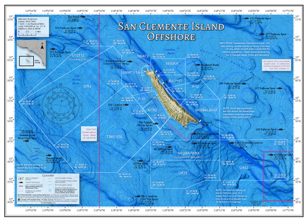
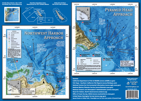
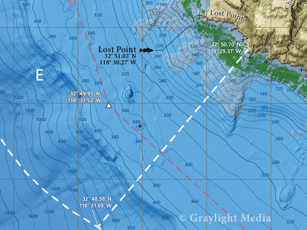
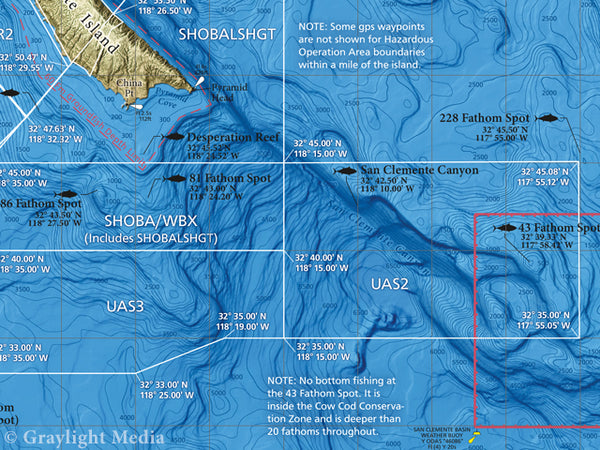
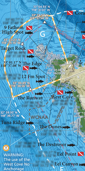
Going far beyond what is available on a NOAA chart, our Private Boater's Guide to San Clemente Island features: 6 full-page maps with over 70 GPS locations of popular fishing spot and dive sites at SCI, essential Navy closure information and GPS boundaries, offshore kite fishing zone boundaries, detailed harbor and anchorage maps, incredible 3-D imagery of the ocean floor, fishing regulation boundaries and much more!
Map Titles
Includes the following full-page map titles, covering specific regions of SCI in detail:
- San Clemente Island Offshore
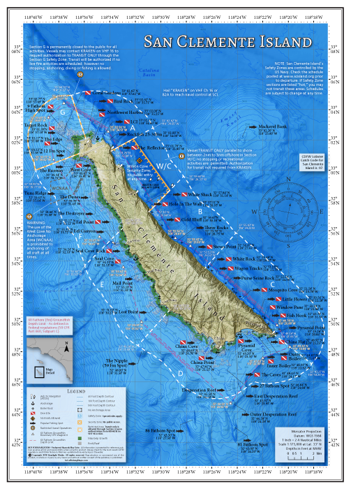
- San Clemente Island
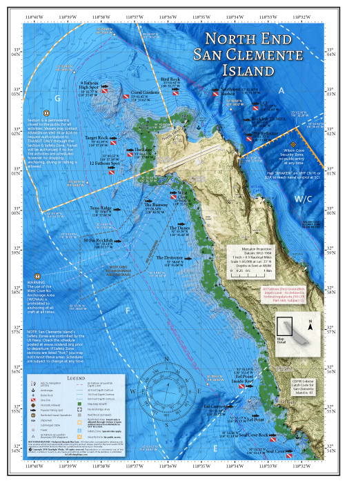
- North End
- Frontside
- South End
- Backside
Simplified Navy Closure Information
Simplified and accurate Navy closure maps with regulation summaries & GPS boundaries of Safety Zones and offshore Hazardous Operations Areas from www.scisland.org. All Navy closure information is overlaid on top of popular fishing spot and dive site locations, giving you an "at-a-glance" reference. Fish and dive at SCI with confidence!
Harbor and Anchorage Areas
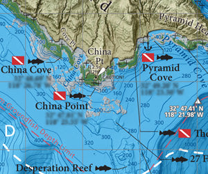
Includes large-scale inset maps of the following anchorage areas at San Clemente Island: Northwest Harbor, Pyramid Cove and Seal Cove. Also includes a large-scale inset map of the Wilson Cove closure area.
Over 70 Popular Fishing and Diving Spots
GPS numbers listed for over 70 popular fishing and diving spots at San Clemente Island, including: Bird Rock, Northwest Harbor, LCI, The Reflector, White Shack, Hole in the Wall, Gold Bluff, Three Rocks, White Rock, Wagon Tracks, Purse Seine Rock, Mosquito Cove, Little Flower, Windowpane, Fish Hook, Pyramid Point, East End Reef, China Hat, Outer Boiler, Inner Boiler, The Caves, Desperation Reef, China Point, China Cove, The Nipple, Mackerel Bank, The 86, The 81, The 381, Lost Point, Mail Point, Seal Cove, Eel Canyon, Eel Point Reef, The Destroyer, The Dunes, Tuna Ridge, The Runway, West Cove, 12 Fathom Spot, The Edge, Target Rock, 9 Fathom High Spot, Coral Gardens and much more!
