10 products

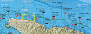
Catalina / San Clemente Is
Catalina / San Clemente Is
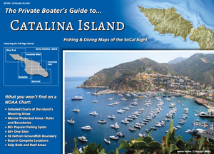
Catalina Island Boater's Guide
Catalina Island Boater's Guide

Horseshoe Kelp / Palos Verdes
Horseshoe Kelp / Palos Verdes

Los Angeles Boater's Guide
Los Angeles Boater's Guide

San Clemente Is Boater's Guide
San Clemente Is Boater's Guide

San Nicolas Is / Santa Barbara Is
San Nicolas Is / Santa Barbara Is

San Pedro Bay / San Pedro Shelf
San Pedro Bay / San Pedro Shelf
SoCal Bight Offshore / SoCal Inner Banks
SoCal Bight Offshore / SoCal Inner Banks

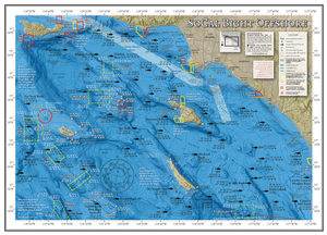
SoCal Bight Offshore Poster
SoCal Bight Offshore Poster
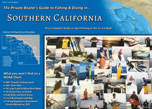
SoCal Boater's Guide
SoCal Boater's Guide