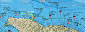
Our maps are more than just 1000+ GPS coordinates of SoCal's best fish and dive spots.
Whether you're fishing for calicos in the kelp, chasing tuna offshore or just cruising the harbor, our maps provide a visual aid to better understand the big picture.
About
Our products provide a comprehensive guide of Southern California waters and are intended to help the private boater catch more fish, get off the beaten path and explore.
It all started with a 13-year-old kid marking up maps of his favorite San Diego County bass lakes with a sharpie. Thirty years later, we are still using maps to find more and better fishing spots.
Cold winter nights hooping bugs in San Diego Bay? Check. Slinging surface iron into the boilers on the backside of Clemente for monster calicos? You bet. Chasing mixed bluefin and yellowfin outside the islands late in the offshore season? Copy that.
We’ve been there. That’s what makes our products stand out from the rest. We make each map because we’re going to use it, and it shows in the details.
See what you've been missing...
Check out our Santa Barbara Island fishing map vs the plain-old NOAA chart on your plotter
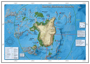
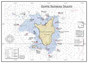
Shaded relief in HD
Incredibly detailed view of the ocean floor with a GPS grid overlay. Sure beats scattered soundings on a white background.
Reefs and Kelp
Fish-holding habitat like rocky reefs and kelp beds are easy to see. Find those ledges, pinnacles and isolated stones that you've been missing.
Local Boating Knowledge
Instructions for landing a dinghy and contacting the Park Ranger are printed right on the map, because you have enough to worry about just making it out there.
Regulation Boundaries
Groundfish depth limits, Marine Reserves and National Park boundaries are clearly visible, so you know where to go. And where not to.
Product Features
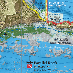
Incredible view of the seafloor
We combine hi-res relief shading with fish-holding habitat like rocky reef, cobble, sand, kelp, eelgrass and boiler rocks. The result is a realistic view of the ocean floor that will make you feel like the local expert no matter where you are.
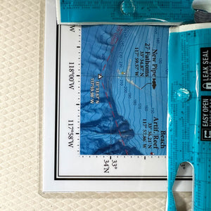
Calibrated GPS grid
Our calibrated GPS grid overlay makes it easy to pull waypoints for any location on the map. Line up two straight edges on the grid. Punch the numbers into your chartplotter and meter around with your fishfinder to home-in on your new favorite fishing spot.
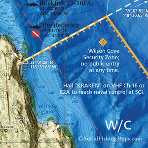
Local boating knowledge
We've got the information you're going to need-to-know while on the water: small craft navigation rules of the road, closed or restricted areas, military areas, speed limits, traffic patterns and more.
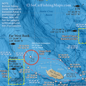
Fishing regulation boundaries
We include boundaries and GPS waypoints of regulation areas, so you can fish with confidence. Plus, simplified regulation summaries are printed right on the map; one less thing to worry about.
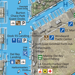
Small craft boating facilities
If you can access it from a private boat, we put it on the map! We even point out dock n' dine restaurants in San Diego Bay, public-access docks in Newport Harbor and dinghy landing spots at Santa Cruz Island.
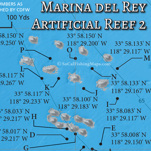
Artificial reef maps
Our maps include a large-scale inset of every artificial reef in Southern California. The public GPS numbers supplied by CDFW only tell half the story. Find out what else is down there with one of our fishing maps.
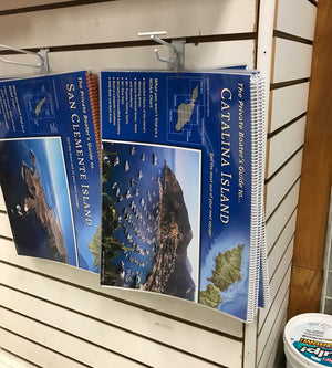
Support your local tackle shop
Want to check out our maps in person? We are proud to have our products available at over 50 dealers throughout Southern California. Click below to find your local shop.
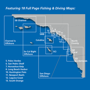
Map Locator
Not sure which map you need? Some of our titles are available in more than one product. Click below to check out the map outlines from our different Boater's Guides.
