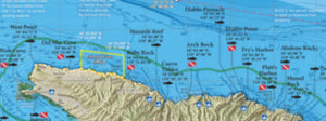
Santa Barbara Channel / Channel Islands Offshore
Shipping calculated at checkout
In stock
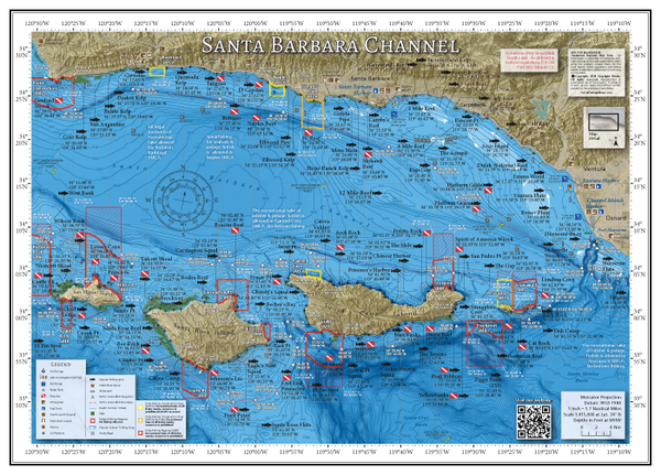
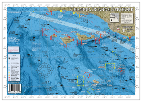
Santa Barbara Channel / Channel Islands Offshore
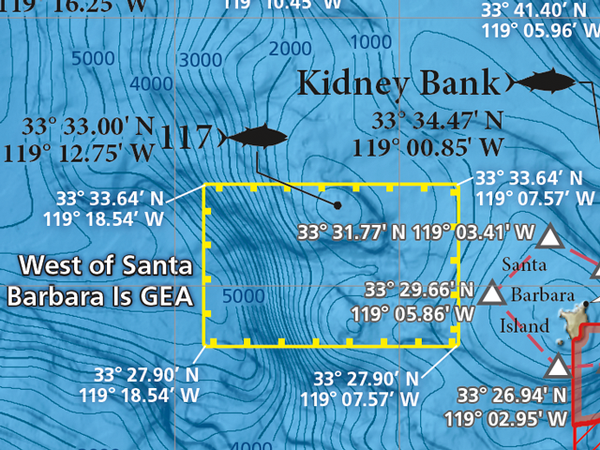
Updated for 2024! We added the new Groundfish Exclusion Areas (GEA's) and 50-fathom groundfish boundaries at SBI and San Nic to our Channel Islands Offshore map. The boundaries, GPS waypoints and a simplified explanation of the new rules are printed right on the map.
Stretching from Pt Conception to Pt Mugu, the Santa Barbara Channel separates the northern Channel Islands from the mainland and is one of the most productive fisheries in the world. Fog, wind, a web of fishing regulations and almost too many fishing options intimidate many a skipper departing from Santa Barbara, Ventura or Channel Islands Harbor. Stay calm and keep it simple with our laminated fishing map, with all the information you need available at just a glance!
Two Maps in One!
Includes 2 map titles, printed back-to-back: Santa Barbara Channel and Channel Islands Offshore.
Marine Protected Areas
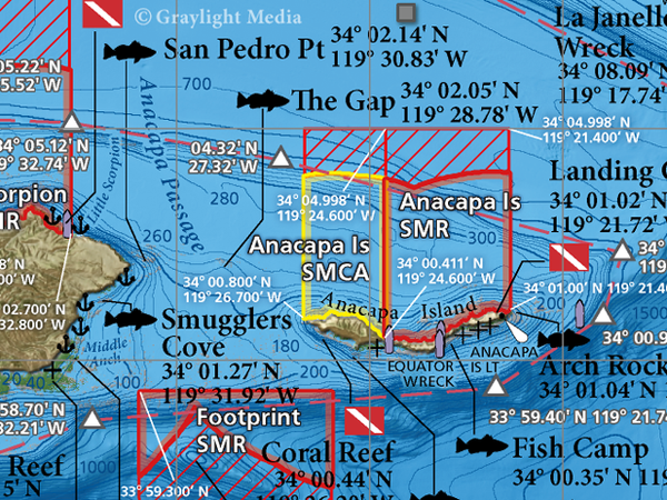
Simplified and CDFW-approved MLPA regulation summaries with GPS boundaries for the following Marine Protected Areas: Pt Conception SMR, Kashtayit SMCA, Naples SMCA, Campus Point SMCA, Richardson Rock SMR, Harris Pt SMR, Judith Rock SMR, Carrington Pt SMR, Skunk Pt SMR, South Pt SMR, Gull Island SMR, Painted Cave SMCA, Scorpion SMR, Anacapa Island SMCA, Anacapa Island SMR, and Footprint SMR.
Fishing Habitat
White sea bass, yellowtail, calicos, halibut, lingcod, rockfish, lobster...our maps show the fish-holding habitat that an angler fishing the Islands needs to know about: rocky reefs, kelp, shipwrecks and boiler rocks. Find new fishing spots on the water using our calibrated GPS grid and the fishfinder on your boat.
Salmon Fishing Areas Clearly Marked
The Santa Barbara Channel boasts the southernmost reliable ocean salmon bite on the West coast. Ocean kings don't push this far south every year, but when the fish are in, the action can be hot and the fleet of boats is thick. Our Santa Barbara Channel fishing map highlights the most popular trolling drags up and down the Channel so you can stay on the fish.
Over 120 Popular Fishing & Diving Spots
GPS numbers listed for over 120 popular fishing and diving spots in the Channel Islands region, including: Gaviotas, Tajiguas, Naples Reef, Ellwood, More Mesa, Mohawk Reef, 12 Mile Reef, Camby's Reef, 4 Mile Reef, 1 Mile Reef, Dulah Reef, Ventura Flats, Wilson Rock, Westcott Shoal, Wyckoff Ledge, Rodes Reef, Bee Rock, Eagle's Nest, Santa Rosa Pinnacles, Becher's Bay, Christy's, Beacon Reef, Chinese Harbor, Anacapa Gap, Gull Island, Blue Banks, Coches Prietos, Yellowbanks, Pink Ribbon, Flame Reef, The Towers, Coral Reef, Footprint Reef, Arch Rock, Cat Rock, Anacapa Landing Cove, Potato Bank, Cherry Bank, Tanner Bank, The Snail, Osborn Bank, Kidney Bank, Hidden Reef, The Boot and much more!
