SoCal Bight Offshore / SoCal Inner Banks
Shipping calculated at checkout
In stock
SoCal Bight Offshore / SoCal Inner Banks
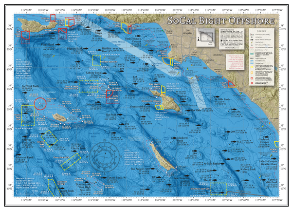
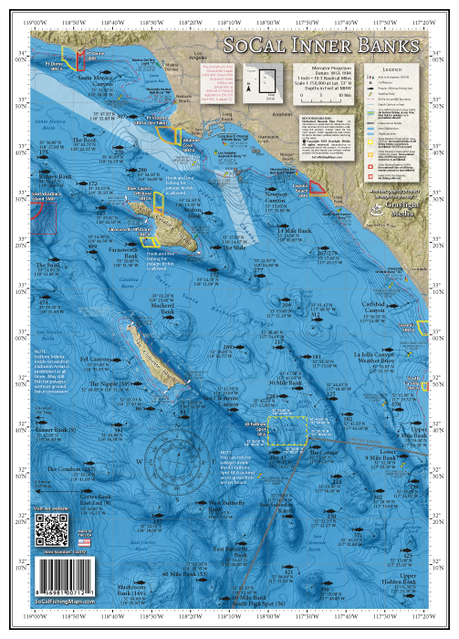
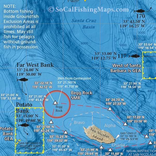
Updated for 2024! We added the new Groundfish Exclusion Areas (GEA's) and 50-fathom groundfish boundaries at SBI, San Nic, the Cortes and Tanner Bank that are in effect for 2024. The boundaries, GPS waypoints and a simplified explanation of the new rules are printed right on the map.
Offshore anglers from LA and OC, these two offshore fishing maps have you covered, whether you're headed west to San Nic or south to the 302 in Mexican waters. This 2-sided laminated map offers GPS locations for over 100 offshore fishing spots in 1-day range from Los Angeles and Orange County harbors.
Two Maps in One Product
Includes 2 map titles, printed back-to-back, covering the offshore fishing areas accessible from Los Angeles and Orange County ports: SoCal Bight Offshore, SoCal Inner Banks.
At-a-glance Reference
Essential information for the offshore angler is overlaid on top of popular offshore fishing spots, including: navy restrictions at San Clemente Island and San Nicolas Island, Marine Reserve boundaries, weather buoy locations, as well as GPS coordinates for the harbor approach buoy of every port from Marina Del Rey to Oceanside.
Over 100 Popular Offshore Fishing Spots
GPS numbers listed for over 100 popular offshore fishing spots accessible from Los Angeles and Orange County harbors, including: Footprint Reef, the Boot, the 270, Hidden Reef, Pilgrim Bank, Kidney Bank, The Snail, Osborn Bank, Far West Bank, Potato Bank, Nidever Bank, Cherry Bank, Tanner Bank, Cortes Bank, the 711, the Condom, The Nipple, the 381, the 86, the 81, San Clemente Canyon, Mackerel Bank, Farnsworth Bank, the 125, The Slide, Avalon Bank, the 289, 14 Mile Bank, the 267/279, the 209, 181, 182, The Corner, 43 Fathom Spot, 9 Mile Bank, Butterfly Bank, Sixty Mile Bank, Mushroom Bank, the 390, San Salvador Knoll, the 302, the 425, the 371, Upper Hidden Bank and much more!


