Huntington Flats / Newport Reefs
In stock
Huntington Flats / Newport Reefs
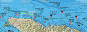
This 2-sided laminated map shows the GPS locations of popular fishing and diving spots of the Orange County coastline between Huntington Harbour and Newport Harbor.
Two Maps in One!
Includes 2 map titles, printed back to back: Huntington Flats and Newport Reefs, both also found in our Private Boater's Guide to Orange County.
Side 1 of this laminated map covers the fishing spots in the Huntington Flats area south of Alamitos Bay and Huntington Harbor, from the Sunset Wreck to the Cliffs area and the Ribbon Kelp in between. Includes hi-def map of Izor's Reef with shaded relief and hardbottom data.
Side 2 of this laminated fishing map covers the fishing and diving spots to the north of Newport Harbor, from the Ribbon Kelp off Huntington Pier down to the harbor entrance and outside to the end of New Pipe and the 108. Includes inset maps of the Huntington and Newport Artificial Reefs. This fishing map is current for 2021 with SoCal's 100-Fathom rockfish depth boundary.
Fishing Habitat
Calico bass, sand bass, white sea bass, halibut, sculpin, rockfish, lobster...our maps show the fish-holding habitat that an inshore fisherman needs-to-know: bottom composition changes, rocky reefs, coarse sand, boiler rocks, jetties, wrecks and all with a calibarated GPS grid overlay so you can pinpoint your next favorite honey hole!
Special Thanks to Capt. Mark Wisch
For a detailed description of many of LA and Orange County's most famous fishing spots and more GPS locations than we could fit on a map, we'd like to give a shout-out to Between Two and Twenty Fathoms by Capt. Mark Wisch. This book is one of the most informative pieces of local fishing knowledge in print today and covers inshore waters from Palos Verdes all the way down the Orange County coast to Dana Point.
Over 100 Popular Fishing and Diving Spots
GPS numbers listed for over 100 popular fishing and diving spots along the Orange County coastline between Huntington and Newport harbors, including: Belmont Is Wreck, Esther Rubble, Surfside Hardbottom, West Huntington Flats, Sunset Wreck, Bolsa Chica Flats, West Bubbles, The Cliffs, The Boiler, Pipeline Rocks, The BTR, Miniature Rock, the 1/4 Acre, Inside Rig, Outside Rig, West Rock, the Ribbon Kelp, the LCI Wreck, the 10&1/2 Spot, Izor's Reef, Barge Rock, East Bubbles, the 108, San Gabriel Canyon, Power Plant, Huntington Artificial Reefs #1,2,3 & 4, Old Pipe, Old Pipe Bend, New Pipe, Drill Pipe, Newport Reef, Orange Street, Double Bubbles, Haystack, Newport Canyon, West Shelf, East Shelf, West Jetty Reef, and much more!