Los Angeles Boater's Guide
Shipping calculated at checkout
In stock
The Private Boater's Guide to Los Angeles County
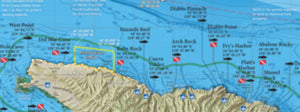
Introducing detailed fishing and diving maps of the Los Angeles County coastline from Malibu to Seal Beach and all areas in between. This map guide contains a wealth of information for the private boater hailing from Marina Del Rey, King Harbor, Los Angeles Harbor, Rainbow Harbor, Shoreline Marina, or Alamitos Bay.
We show fishing regulation boundaries like the 40-fathom fishing boundaries within Cowcod Conservation Areas, Marine Protected Areas and rule summaries, as well as local "no fishing" or "no diving" zones closer to the harbor. Fish and dive with confidence with our LA County Boater's Guide!
Map Titles
Includes the following map titles:
- So Cal Bight Offshore
- Santa Monica Bay
- Palos Verdes
- Horseshoe Kelp
- San Pedro Shelf
- Long Beach Harbor
Artificial Reef Maps
Our fishing and diving maps are more than just GPS numbers. We include hi-def maps of artificial reef sites so you can see the actual structure on the map.
Small Craft Harbor Facilities
Our bay maps show small craft harbor facilities like marinas, fuel docks and boat ramps, traffic patterns, water ski areas, 5 mph zones, waterski zones, swimming areas, guest docks, public access docks, kayak launches and more.
Special Thanks to Capt. Mark Wisch
For a detailed description of many of LA County's most famous fishing spots and more GPS locations than we could fit on a map, we'd like to give a shout-out to Between Two and Twenty Fathoms by Capt. Mark Wisch. This book is one of the most informative pieces of local fishing knowledge in print today and covers inshore waters from Portuguese Bend in Palos Verdes all the way down the Orange County coast to Dana Point.
Over 300 Popular Fishing and Diving Spots
GPS numbers for over 300 popular fishing and diving spots along the Los Angeles County coastline are included in The Private Boater's Guide to Los Angeles County, such as: County Line, Harrison's Reef, Leo Carillo, Decker Canyon, Pt Dume Pinnacles, Big Kelp Reef (BKR), Paradise Cove, Escondido Beach, Latigo Reef, Corral Beach Reef, Pepperdine, Colony Kelp, Malibu Kelp, Malibu Rockpile, Rockhouse Reef, Carbon Beach, Malibu Artificial Reef, Las Flores Kelp, Big Rock, Burnt House, Topanga Bubbles, Temescal, Long Wharf, Star of Scotland Wreck, Santa Monica Artificial Reef, Twin Towers, Ocean Park, Short Bank, South Bank, Volcanic Reef, Palawan Wreck, Malaga Cove, Bit Rock, Haggerty's Crane, Bay Junk, Rocky Point, Seabass Rock, Christmas Tree Cove, Pt Vicente, Marineland, Beanies, Portugese Point, Cherry Tree, K.O.U. Rock, Royal Palms, Whites Point, Pagoda Rock, Whites Point, Point Fermin, Horseshoe Kelp, The Rockpile, Red Tank, Middle Grounds, Olympic II Wreck, Southeast Rock, 14 Minute Wreck, Potter's Reef, High Kelp, White Spot, 105 Area, 150 Kelp Reef, Double Rigs Reef, and much more!