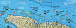
San Diego Bay / Mission Bay
In stock
San Diego Bay/Mission Bay
Due to popular demand, we printed up the two bay maps in our best-selling Private Boater's Guide to San Diego County and are selling them both in one product! This 2-sided laminated map offers a wealth of information for the fisherman, as well as the private boater!
Two Maps in One
Includes 2 map titles, printed back-to-back: San Diego Bay, Mission Bay.
Fishing Habitat
Bass, halibut, corvina, bonefish, lobster...our maps show the fish-holding habitat that a bay fisherman needs to know: eelgrass beds, clam beds, rocky reefs, jetties, wrecks, kelp, docks, piers and much more!
Smallcraft Harbor Facilities
Our maps have the names and locations of the following types of small craft facilities: marinas, transient anchorages, mooring areas, public dock access, public boat ramps, dock & dine restaurants, fuel docks, sportfishing landings, waterski areas, swimming areas, 5 mph zones, harbor patrol offices, IGFA-certified weigh-in scale, dockside fish processor, US Customs dock, bayside lifeguard towers, and much more!
Over 50 Popular Bay Fishing Spots
GPS numbers listed for over 50 popular fishing spots in San Diego and Mission Bay, including: the Cable Crossings, Tom Ham's, the Submerged Jetty, the Marriott, NAB Flats, Embarcadero, City Docks, the Jetty Cut-through, the Old NEL Pier, Government Island, Sea World Docks, Sail Bay Grass Flats, Ventura Bridge, Quivira Jetty and much more!